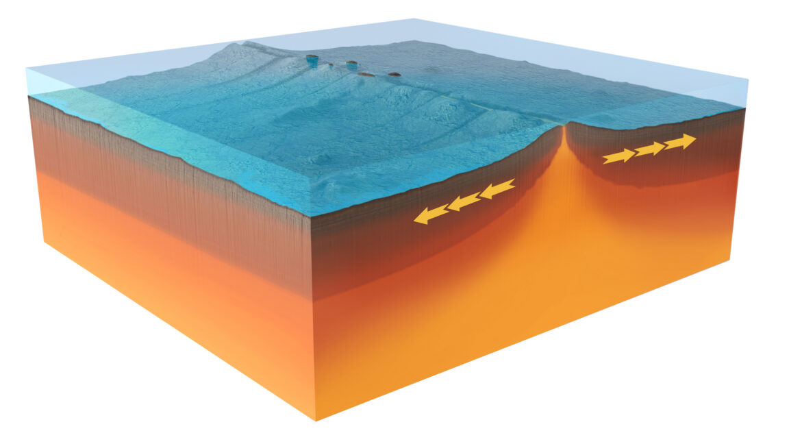
A newly installed French seafloor monitoring network recorded a mid-ocean ridge doing in days what its long-term average rate would take decades to accomplish, according to a 2026 paper in Nature.
The observations matter because mid-ocean ridges build new ocean crust, but much of that work happens far from land and under kilometers of water. Scientists have mapped plenty of finished crust. Watching the machinery run in real time is harder. In this case, the instruments were already sitting on the boundary between the Australian and Antarctic plates when the ridge became active in April 2024.
The site is remote even by oceanographic standards: near the Amsterdam-Saint Paul Plateau, roughly between Australia and Madagascar and south of India. The rift cuts through a plateau interpreted as the surface expression of a deep ocean hotspot. France maintains research stations on the nearby islands of Amsterdam and St. Paul, and French vessels periodically service scientific equipment in the area.
The research team used that logistical lifeline to place monitoring stations along the spreading zone. The array included hydrophones to estimate the locations of seismic events and acoustic instruments to measure changes in distance between sites on the seafloor. Later ship visits mapped the seabed in three dimensions to compare the before-and-after topography.
A fast opening on a slow ridge
Previous work put the ridge’s average spreading rate at a little over 60 millimeters per year. Its shape is otherwise familiar: a central depression about 2,000 meters deep, bordered by rough ridges.
In April 2024, the instruments recorded a sequence of events that first migrated south along the spreading center, ending more than 8 kilometers from the starting point. A second sequence then moved north across about 9 kilometers. The researchers interpret that pattern as dyke formation, meaning molten rock forced its way into long, narrow fractures in the crust.
At the same time, sensors in the central valley began sinking. As the dyke activity continued, that subsidence sped up to about 5 centimeters per minute before slowing. Over six days, the instruments dropped by 4.2 meters in total.
The team argues that the sinking reflects drainage from a magma reservoir beneath the ridge. Nearby instruments also recorded warmer water, which the researchers say is consistent with magma interacting with seawater. While this was happening, instruments on opposite sides of the valley moved apart, in some cases by well over a meter.
Seismic data missed part of the action
After activity returned to background levels, a French research vessel remapped the area. The imaging resolution was limited, but the researchers reported seabed changes too large to dismiss as instrument error. Some locations stood more than 90 meters higher than before. One deposit stretched more than 4 kilometers, and the team estimated that about 150 million cubic meters of new material had been added.
To connect the observations, the researchers modeled possible combinations of magma sources, dyke dimensions and fault geometries. They tested 10 million configurations. Only 2,200 matched the measurements, and those successful models shared several traits: collapse of a deep, horizontal magma body known as a sill, transfer of some magma into a connected dyke, dyke expansion, and fault movement of about 2 to 4 meters.
The team estimates that the event produced extension equivalent to 38 years of spreading at the ridge’s average rate. They also suggest this burst-like behavior may be a common mode of mid-ocean ridge growth: stress and magma accumulate, then the crust adjusts quickly.
One awkward detail for anyone trying to reconstruct seafloor spreading from earthquakes alone: some deformation had no clear tectonic signal in the hydrophone data. The planet, as usual, declined to make the measurement problem convenient.
This story draws on original reporting from Ars Technica.