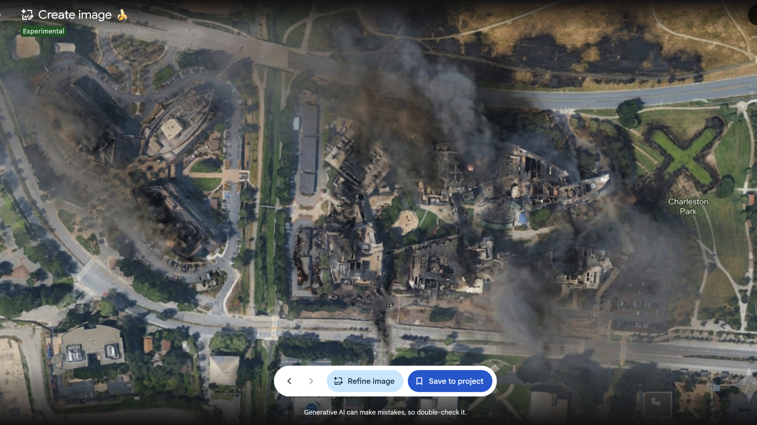
Google’s Google Earth AI tool rollback came a day after the company added Nano Banana 2 image generation to the mapping service. The feature let a user open a real location in Google Earth on the web, select “create image,” and use a text prompt to generate a synthetic scene based on satellite, aerial or 3D imagery. Google said on July 31 it was pulling the feature back while it develops “stronger guardrails.”
The retreat matters because Google Earth is routinely treated as a view of an actual place. Google’s tool did not change the map for other users in the main Google Earth experience, the company said. It did, however, let people create images tied to real coordinates, then download or screenshot them for circulation somewhere that context is absent.
Why did Google roll back the Google Earth AI tool?
Google said it had seen people sharing screenshots of generated imagery that appeared to violate its policies. The company also said geospatial professionals had found useful applications for the tool, but did not say when, or whether, it would return.
Google’s original pitch included historical visualization, classroom material and imagery depicting completed real-estate projects. Bryan Horowitz, a Google Earth product manager, said users could zoom to a location and enter a prompt. That same mechanism also made fabrication cheap and location-specific.
BBC Verify reported creating false scenes of a collapsed Eiffel Tower, a sinkhole at the Great Pyramid of Giza and Russian tanks in Kyiv. NPR reported producing images of fires on Iran’s Kharg Island and a flooded U.S. Capitol complex, events that had not occurred. Independent investigator Henk van Ess showed generated examples involving refugees near the U.S.-Mexico border and a nuclear plant in Iran, according to Ars Technica. These were tests, not depictions of real events.
What happens when AI images leave Google Earth?
Google said generated images carried its SynthID AI watermark and could be checked through Gemini or Google Lens. The company also said the images were not visible to other people inside the main Google Earth experience. Those are useful constraints inside Google’s own product. They do much less once an image is exported, cropped, re-encoded, screen-recorded or photographed.
BBC Verify found that small prompt changes could bypass some restrictions on harmful content. Its testing said watermark checks generally identified feature-generated images, but it also found cases in which Gemini could be led to call fake Google Earth images real; outside AI-detection tools sometimes missed them as well. Ars Technica reported that SynthID did not return verification after it photographed an AI-altered image with a smartphone camera.
That leaves a fairly mundane but serious provenance problem. A shared image may no longer retain original metadata or reliable provenance, while its familiar Google Earth setting can lend a fabricated claim a veneer of credibility. Van Ess and other researchers warned that the same dynamic could make it easier for people to cast doubt on authentic imagery by alleging AI manipulation. That is a reported risk, not an established result.
Google has confirmed only a rollback while it works on safeguards. The company has not set a return date or described the controls it plans to add.
This story draws on original reporting from Ars Technica.