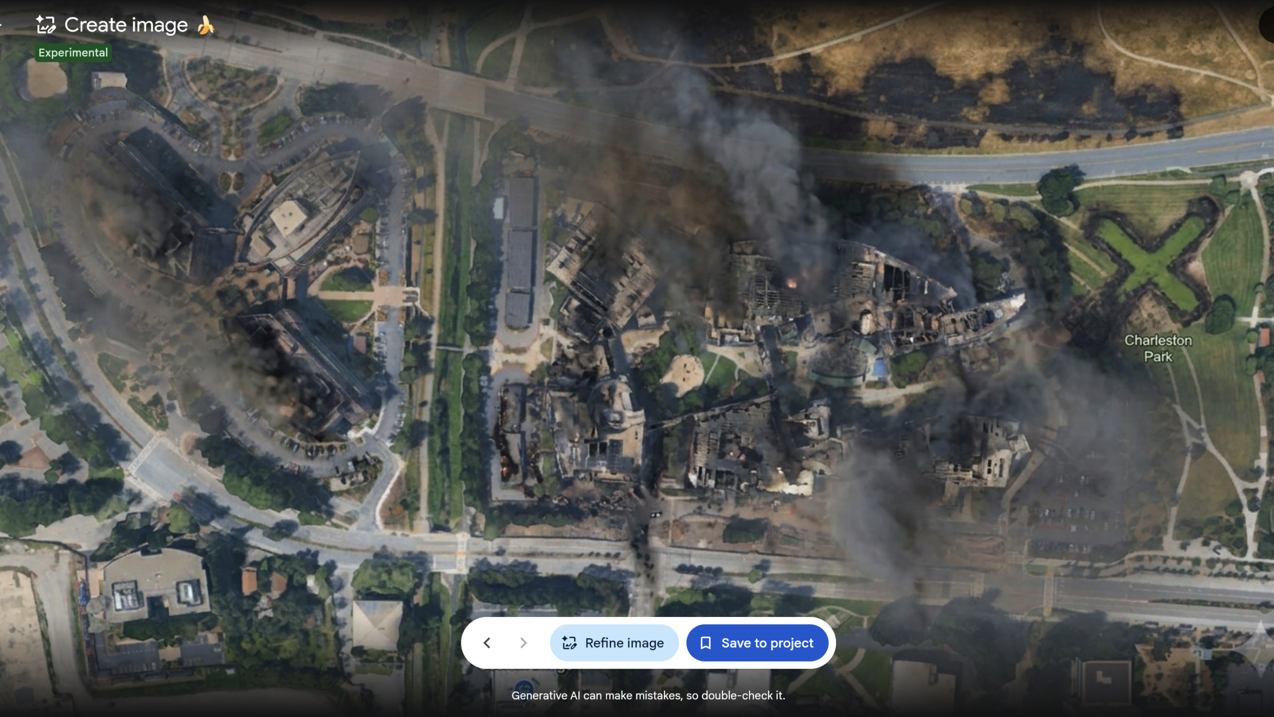
Google’s Google Earth AI tool rollback came a day after the company added Nano Banana 2 image generation to the web version of the mapping service. Google said on July 31 that it was withdrawing the feature while it develops stronger guardrails, after seeing shared screenshots of generated imagery that appeared to breach its policies.
The retreat matters because Google Earth is used by journalists, researchers and open-source investigators as a reference for real locations. The company did not alter its shared satellite imagery for everybody. Instead, an individual user could open a location in Google Earth on the web, choose “create image,” enter a prompt, and receive a new image built from that place’s satellite, aerial and 3D context.
Why did Google roll back its Earth AI image tool?
Google’s July 31 update said it had found useful uses among geospatial professionals, but also screenshots that appeared to violate policy. The company said it was pausing the capability to add stronger safeguards. It did not say the tool had been permanently cancelled.
Google initially promoted historical visualization, location infographics, proposed real-estate developments and before-construction project views as potential uses. Its examples included a reconstruction of ancient Pompeii and a planned development on an empty lot. Those are company-proposed applications, not a justification for bolting an image generator onto a service people use to check what is actually on the ground.
Critics promptly demonstrated the other use. BBC Verify generated test scenes depicting a collapsed Eiffel Tower, a sinkhole at the Great Pyramid of Giza and Russian tanks in Kyiv. Independent investigator Henk van Ess created fictional images of a nuclear plant in Iran, refugees at the US-Mexico border and damage near a hospital in Gaza, according to BBC Verify and Ars Technica.
Was Google Earth’s satellite imagery changed for all users?
No, according to Google. The company said generated images were watermarked and did not appear in the main Google Earth experience for other people. The risk was distribution: an image tied to actual coordinates and plausible terrain could be downloaded or captured in a screenshot, then shared elsewhere stripped of its context.
That distinction does not make the verification problem disappear. Sam Stockwell of the Alan Turing Institute told the Financial Times that Google Earth has been a benchmark layer for journalists and investigators assessing suspicious images. Researchers warned that fabrications made on top of genuine geographic context could inherit some of that credibility, particularly during conflicts or fast-moving disasters.
Could people identify images created by the tool?
Google said images created by its AI tools carried invisible SynthID watermarks and could be checked through Gemini or Google Lens. BBC Verify found those checks generally worked on its test images, but said it could circumvent them and induce Gemini to describe fake Google Earth images as real; some outside detection tools also failed in some cases.
Ars Technica found SynthID could identify Google AI editing in several images made with the feature before the rollback. But when its reporters photographed an AI-altered image with a smartphone camera, SynthID could not verify it. That result is a practical warning for anyone evaluating a reshared image rather than an original file: a passing or missing detection result alone is not enough to establish what happened at a location.
This story draws on original reporting from Ars Technica.