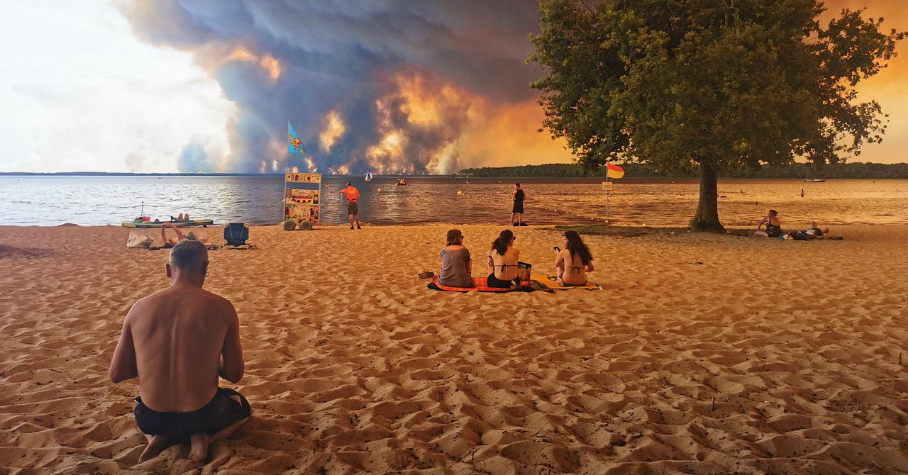
France has recorded its first documented pyrocumulonimbus cloud, a fire-generated thundercloud, as wildfires across France and Spain push firefighters into conditions that are becoming harder to fight with conventional tactics.
A spokesperson for the French firefighter association told AFP that crews were facing an “operational impossibility,” describing the fire behavior as a “natural force beyond our control.” The warning is not poetry. These clouds can make a fire system more violent by adding lightning, downdrafts, and in the most extreme cases, tornadoes.
Wildfires have burned more than 220,000 acres in France so far this year, according to data from the European Forest Fire Information System. That is six times the country’s annual average and 61,000 acres above the previous yearly record cited in the data.
The same European system shows that last week was France’s most destructive week for wildfires in the past 20 years, the period for which accurate satellite data is available. The area burned was more than double the previous weekly record in that span.
What is a pyrocumulonimbus cloud?
A pyrocumulonimbus cloud forms when an intense fire drives hot smoke high into the atmosphere, where it meets cooler, moister air. Water vapor condenses around ash particles, droplets form, and as the column keeps rising those droplets can freeze into ice crystals, building a thunderstorm cloud made by the fire itself.
Meteorologists also call the phenomenon cumulonimbus flammagenitus, which is accurate and sounds like somebody let a heavy metal band name a cloud. The physics is less theatrical: a large heat source, dry air near the surface, and cooler, relatively moist air higher up create the lift and condensation needed for the cloud to grow.
The catch is that these clouds are not reliable firefighting help. They may not deliver meaningful rain over the flames. Instead, they can throw lightning into dry terrain, starting new fires, and produce strong downward bursts of air that hit the ground and spread flames faster.
Pyrocumulonimbus clouds have been documented before in places including the United States, Canada, and Australia. France has had wildfires before, but the current fires are outside the country’s recent norms in size and intensity, according to the European fire data cited above.
Climate change is part of the mechanism, not a garnish. Burning fossil fuels has warmed the planet, increasing the conditions that support explosive fire behavior. A 2024 study in Nature found that the global occurrence of extreme fires more than doubled from 2003 to 2023, with six of the seven most extreme years occurring since 2016.
Fire conditions may worsen again after a brief dip in temperatures over the weekend. Forecasts cited for the region put temperatures later this week above 104 degrees Fahrenheit, or 40 degrees Celsius, in France and 108 degrees Fahrenheit in Spain. For crews already dealing with fires capable of making their own weather, that is the operational problem in plain language.
This story draws on original reporting from WIRED.