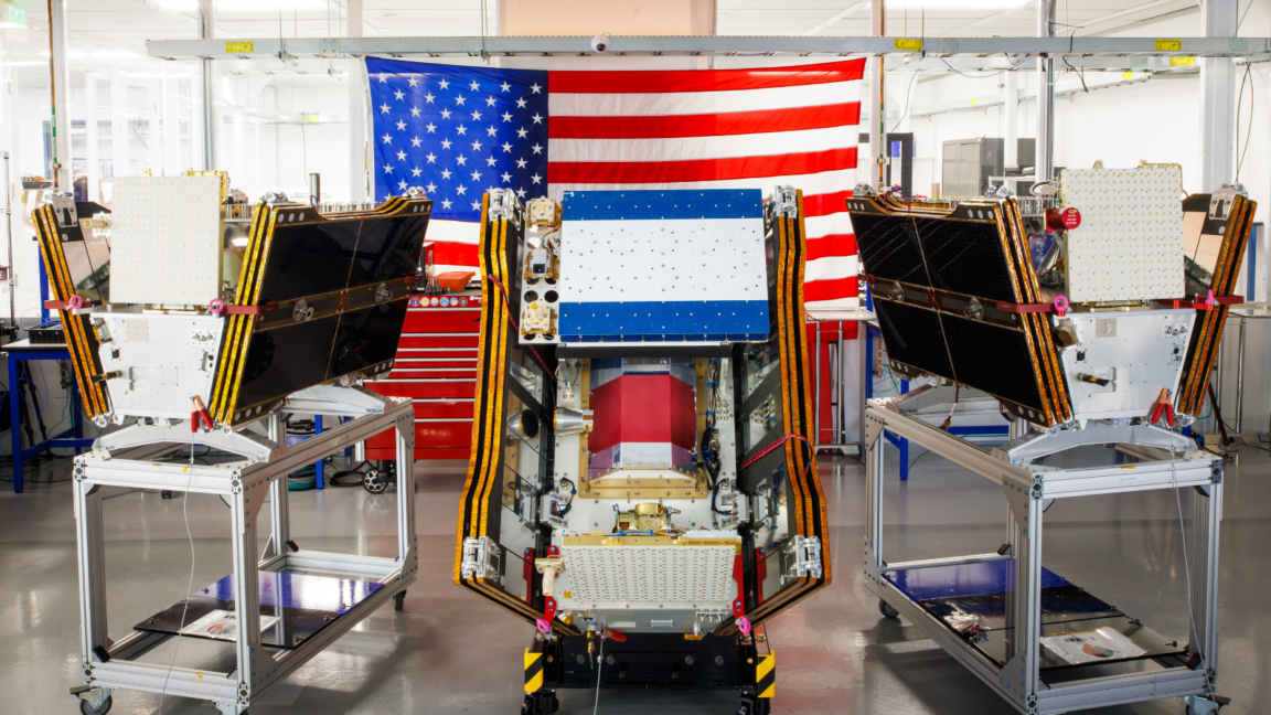
The first three operational satellites in the FireSat wildfire-detection program reached orbit on July 7, giving fire agencies a new orbital sensor network as smoke from Canadian fires spread across large parts of the United States and Canada.
The microsatellites launched on a SpaceX Falcon 9 from Vandenberg Space Force Base in California, according to Earth Fire Alliance, the nonprofit managing the constellation. After about three months of checkout, the group says the satellites will begin supplying data to fire agencies and cover fire-prone regions worldwide at least twice per day.
FireSat is built for a specific job: finding wildfires early, including small starts that broader Earth-observation systems can miss. Muon Space, a California satellite manufacturer, designed the spacecraft. Google has put more than $15 million into the program’s early deployment, according to Google Research, while the Bezos Earth Fund has committed $26 million.
Each satellite carries multispectral imaging sensors designed to see through smoke and clouds and detect fires as small as 5 meters by 5 meters, roughly 16 feet by 16 feet. Earth Fire Alliance and Muon Space say a prototype satellite launched in March 2025 collected more than 1 million images and showed it could pick up low-intensity fires that existing satellites did not see.
The first agencies slated to use FireSat data this year include organizations in California, Colorado, Australia and Portugal, according to Earth Fire Alliance. The program’s roadmap calls for hourly imagery anywhere on Earth by 2029 as more satellites launch. If the full constellation of more than 50 satellites is deployed by the early 2030s, FireSat aims to cut the revisit time to 20 minutes.
Earth Fire Alliance has projected that even an hourly revisit rate could help avoid more than $1 billion in fire damage costs, prevent nearly 22 million tons of carbon emissions, protect 3,500 homes and spare 1.3 million acres of land. Those are program projections, not measured outcomes from the operational constellation, which has only just begun its checkout phase.
Google Research says it plans to apply its AI models to FireSat imagery by comparing new observations with historical images, with the goal of identifying small fires and improving predictive wildfire modeling. Google described the launch as a step toward using AI for climate resilience. That framing comes with baggage: Google has also acknowledged the difficulty of supplying enough clean power for its expanding data-center fleet, and its company-wide electricity use rose 37 percent in 2025.
Fire detection is one piece of the wildfire problem, not a replacement for crews, aircraft, prescribed burns or land management. In Canada, provinces usually carry much of the burden for buying or contracting firefighting aircraft, according to reporting cited by The Conversation. The Canadian government said this year it leased 10 new aerial firefighting aircraft for use as surge capacity by provinces.
The Canadian Wildland Fire Information System listed nearly 900 active wildfires as of July 17, with more than 3,600 fires so far this year burning more than 6.6 million acres. Some fires listed as out of control are being monitored rather than actively attacked, a triage choice agencies make when aircraft, crews and firefighter safety are constrained.
Climate change is making that math worse. The Canadian Climate Institute has said two of Canada’s most destructive wildfire seasons occurred in 2023 and 2025, and the last three fire seasons ranked among the 10 worst on record. Werner Kurz, a retired senior research scientist at Natural Resources Canada, told The Atlantic that hotter and drier conditions are exposing forests to more risk and overwhelming older suppression strategies.
This story draws on original reporting from Ars Technica.